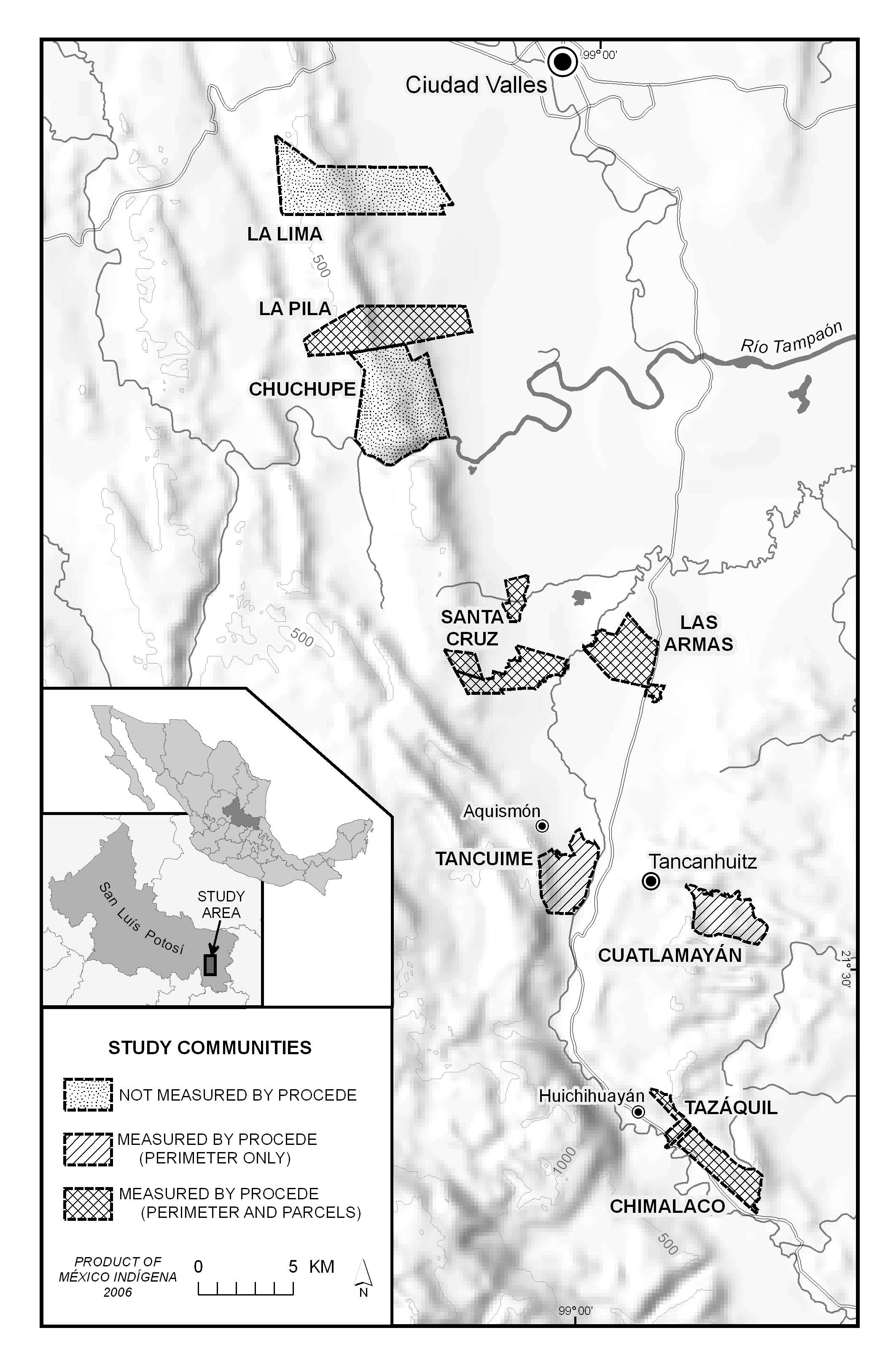
Huasteca Potosina study area
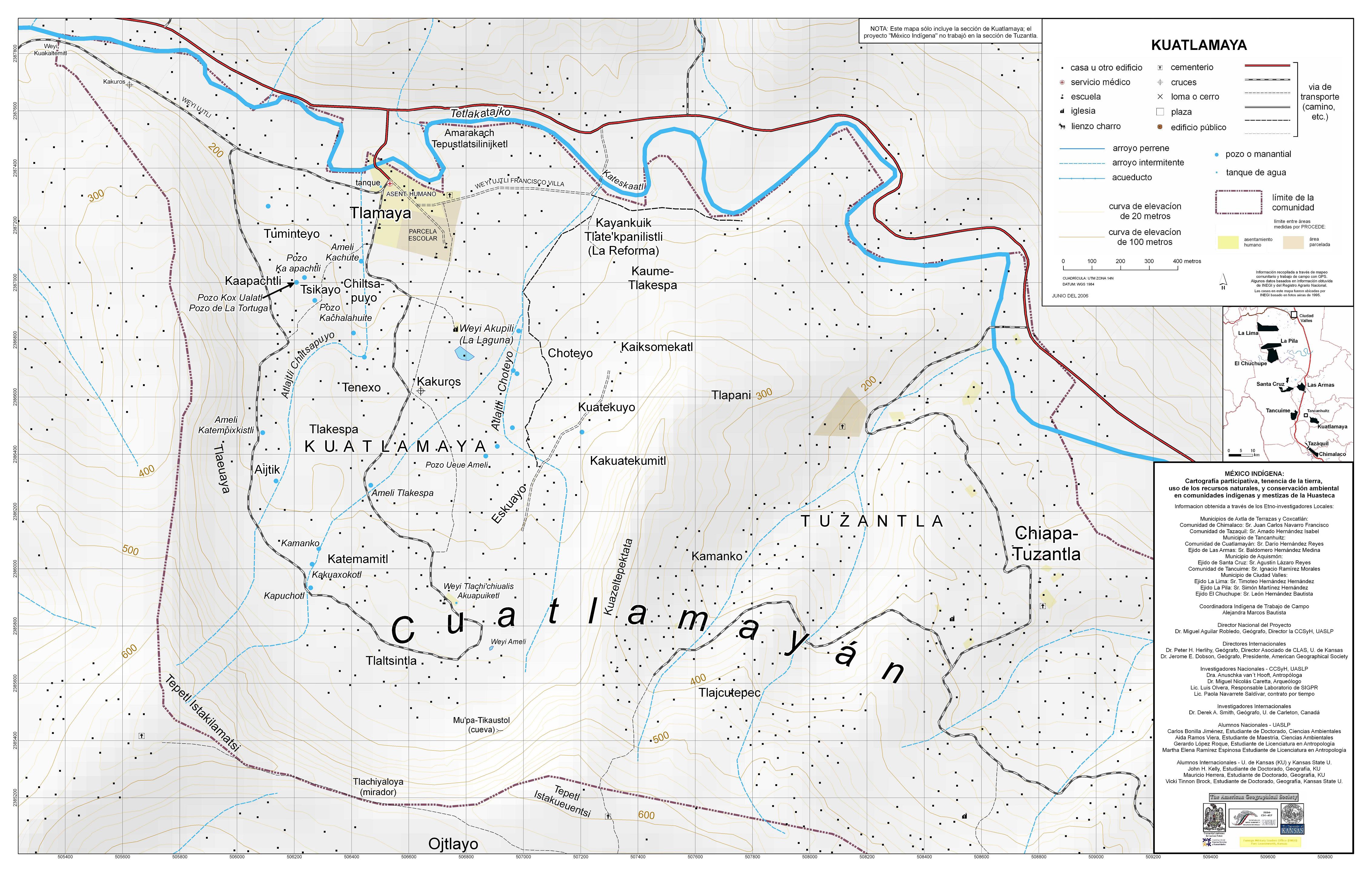
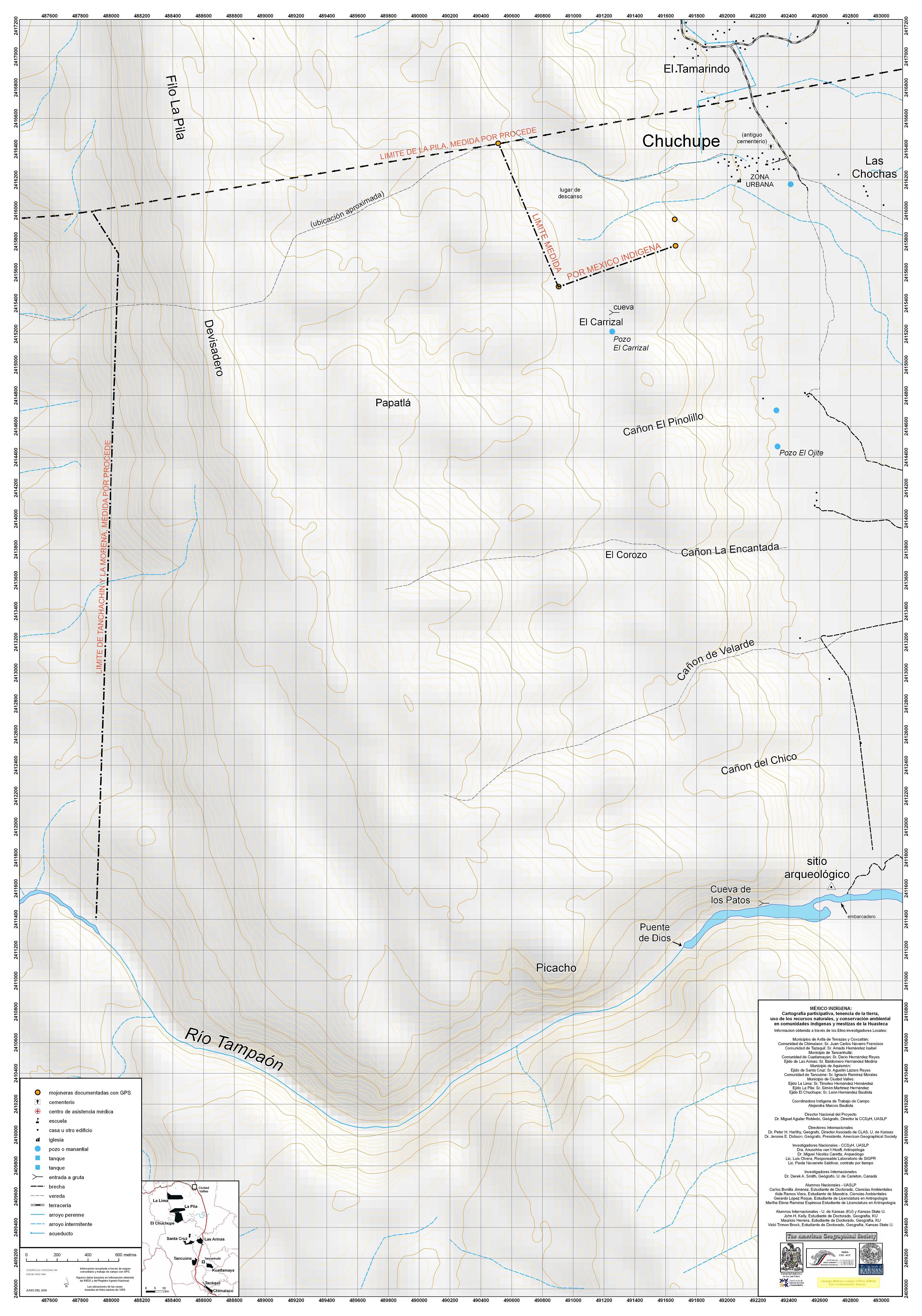
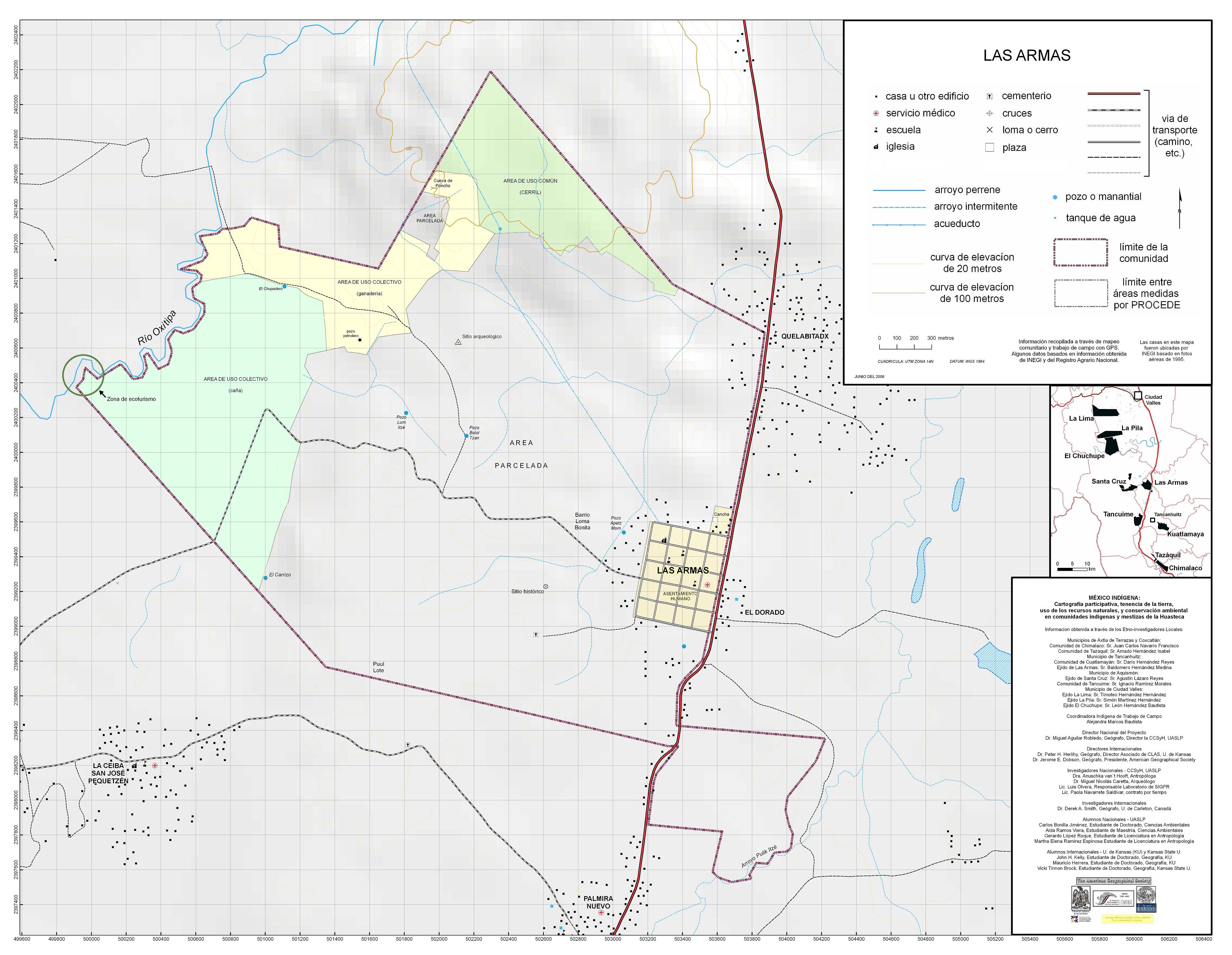
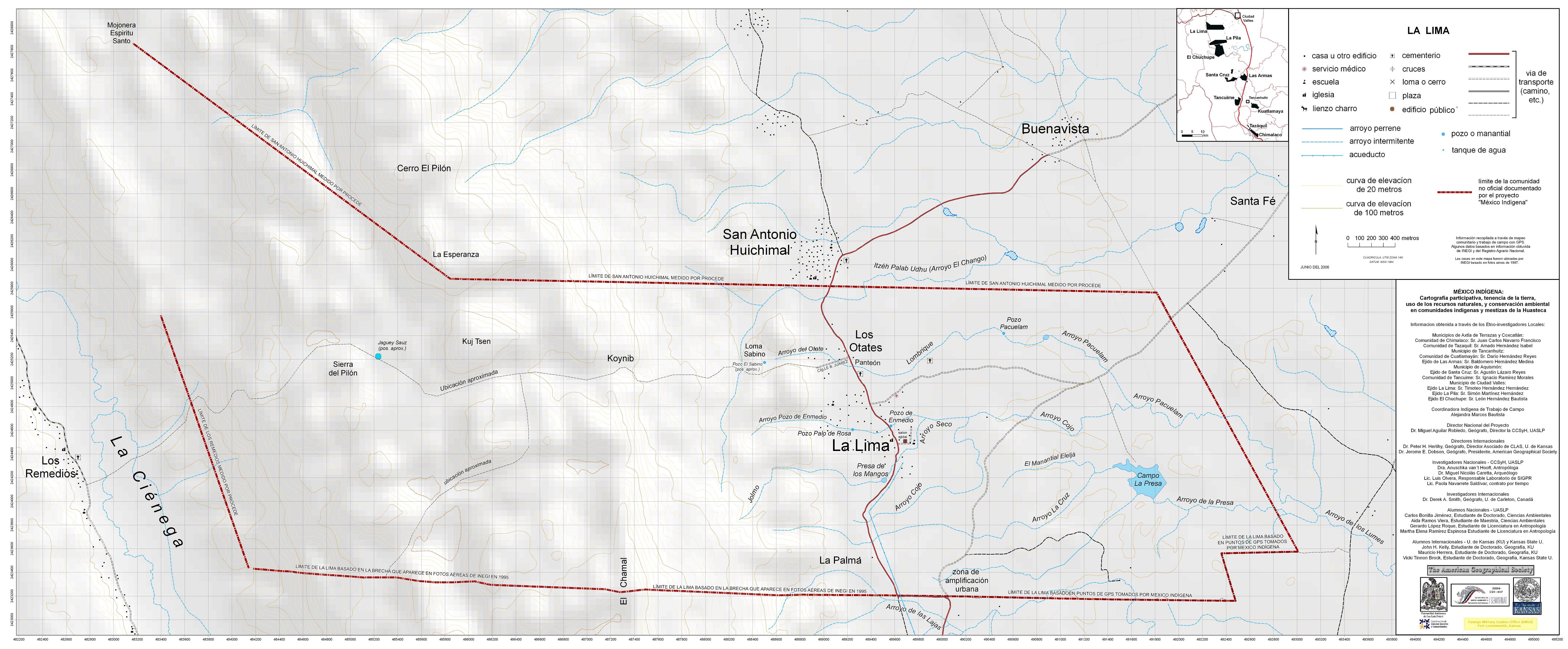
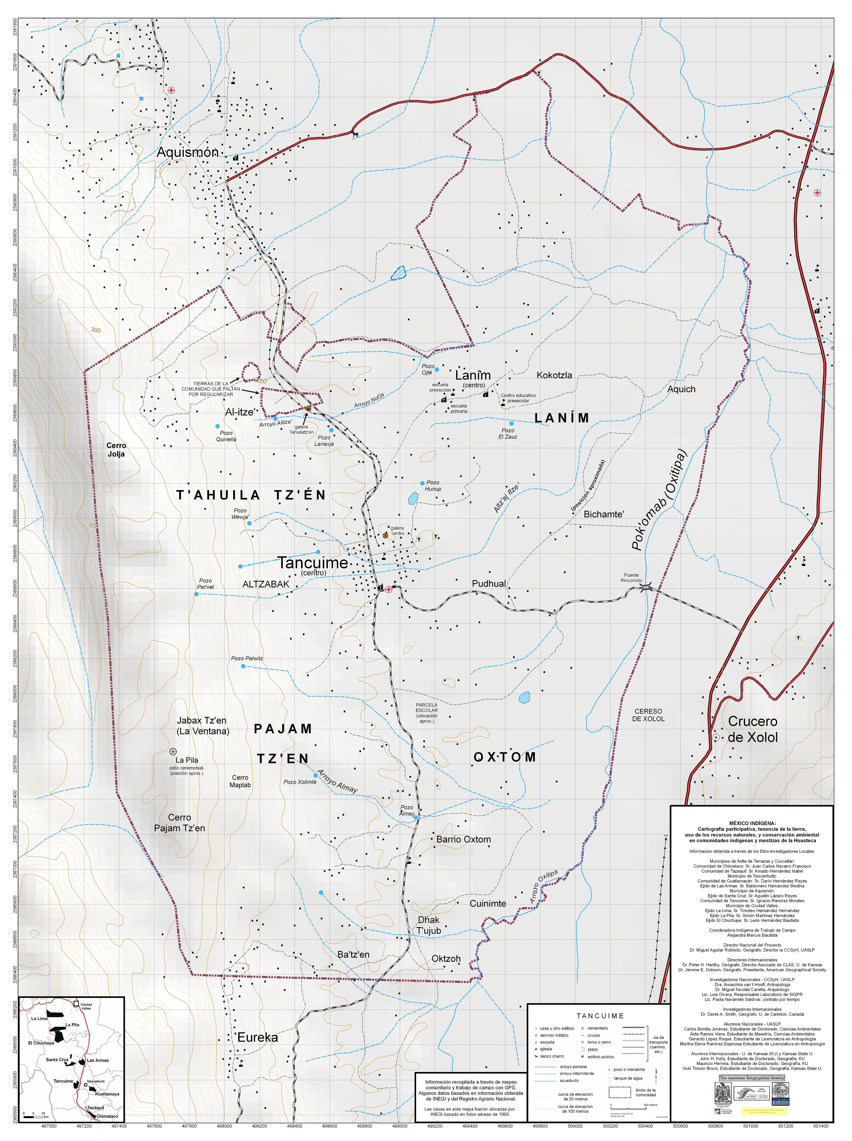
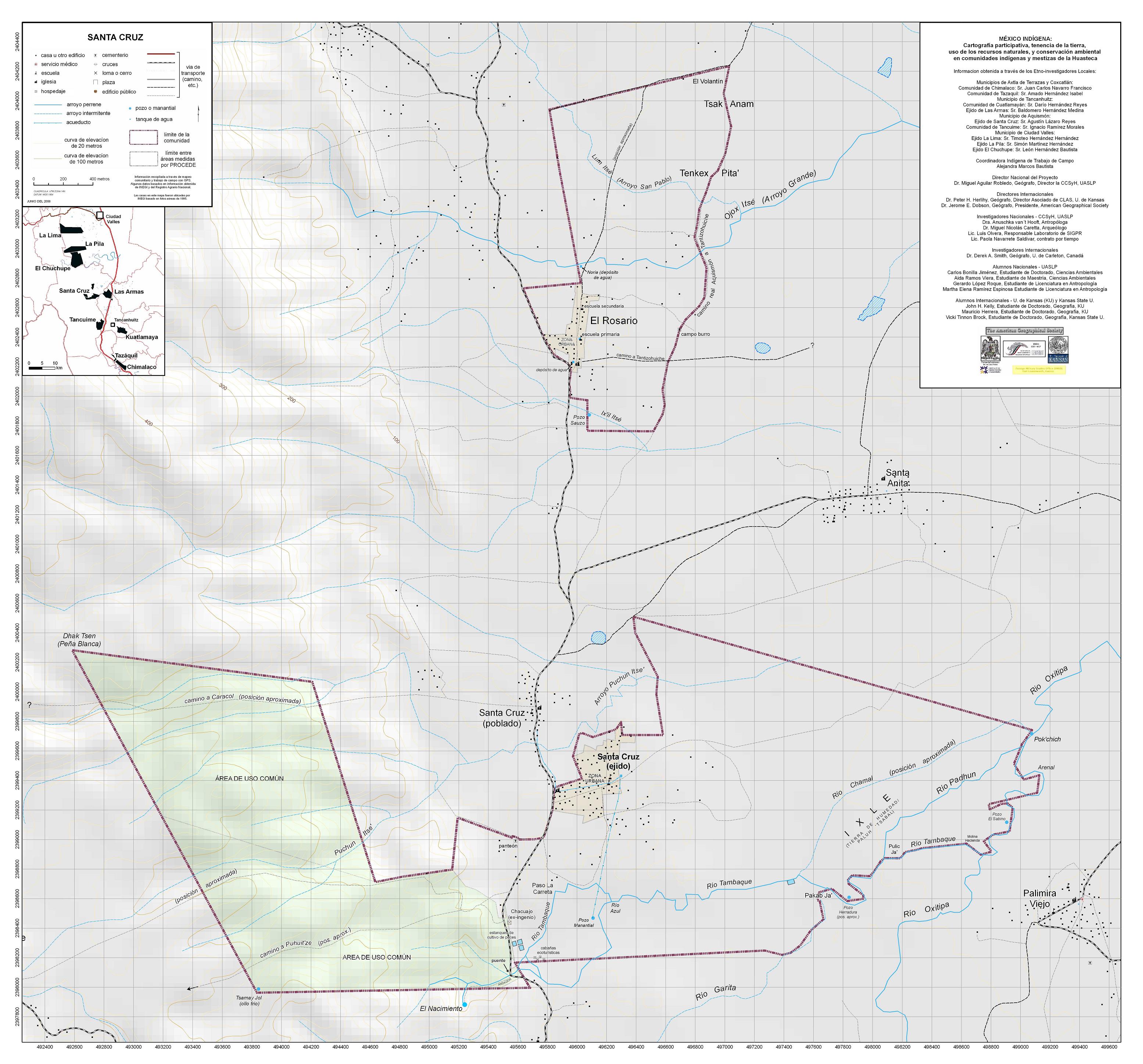
COMMUNITY MAPS (jpegs)Click on any thumbnail to view |
|
|
 |
 |
 |
 |
 |
 |
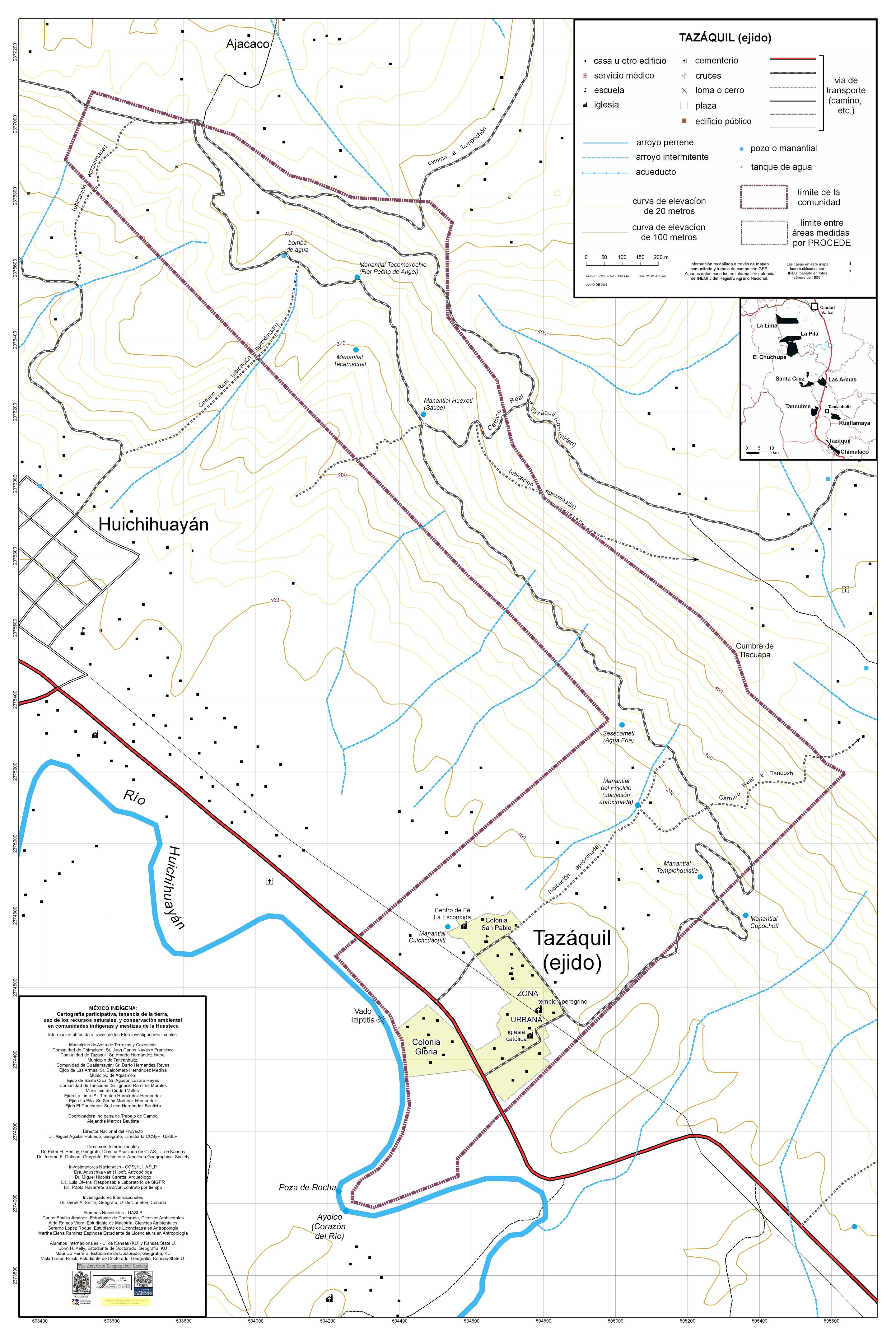 |
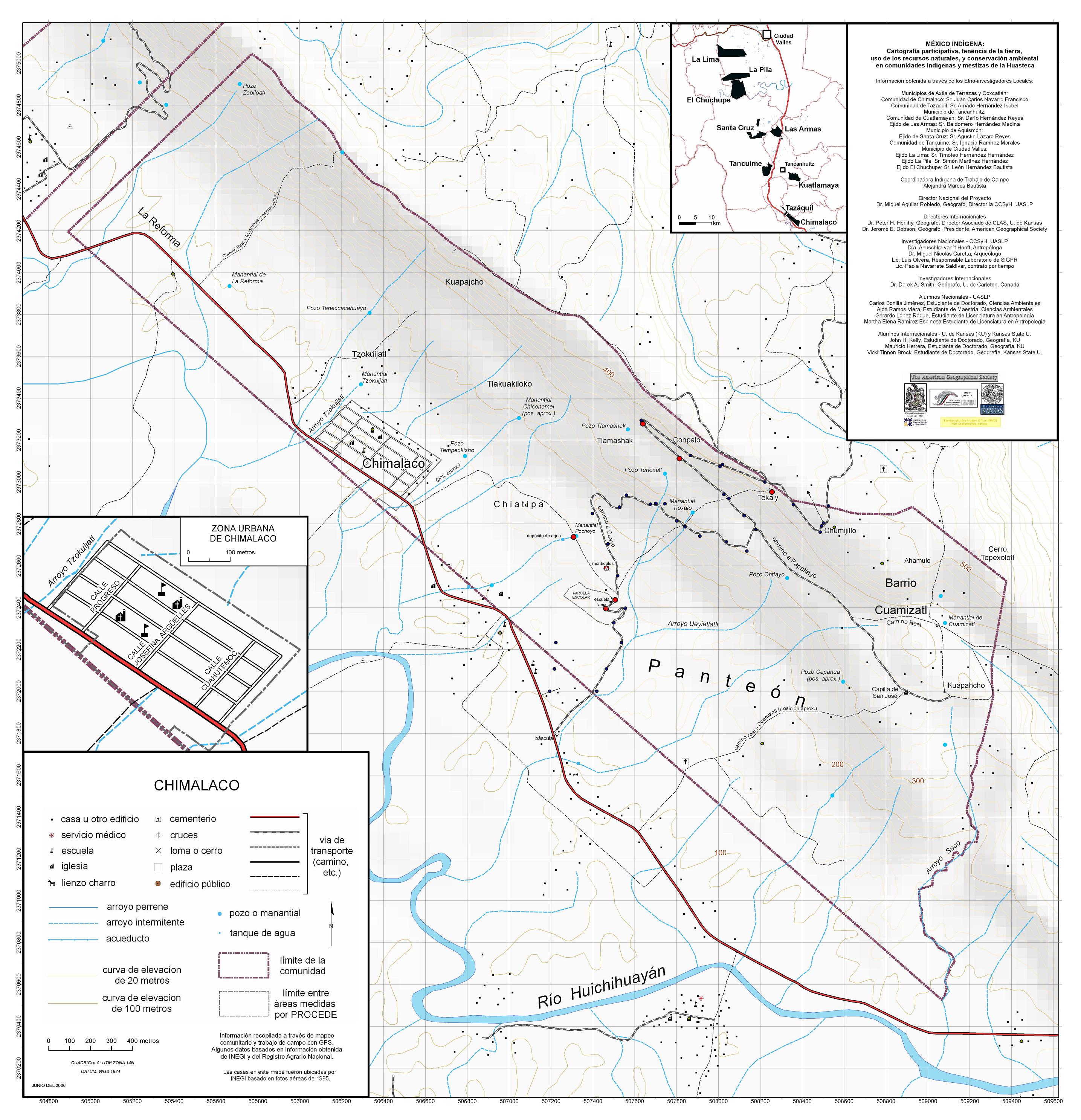
Excerpt from preliminary June 2006 report
Click here to download entire Huasteca chapter (pdf)
|
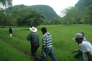
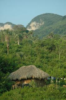
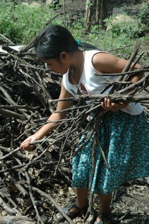
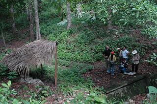
The nine communities in the Huasteca Potosina that participated in the México Indígena project are located along the far eastern edge of the calcareous Sierra Madre Oriental mountain range, and into the shale-and-alluvium coastal plain of the Gulf of Mexico. Our study area includes portions of the limestone range Sierra La Pila, which reaches elevations over 700 meters, part of the complexly-eroded hilly shale-sandstone formation known as the Sierra Tancanhuitz, as well as parts of the nearby plains. Rainfall increases toward the southwest, for two reasons: increasing distance away from the subtropical high pressure band characteristic of arid northern Mexico, and orographic precipitation of Gulf-origin easterlies in the Sierra Gorda and, to a lesser degree, in the other hilly areas. Generally the rainfall regime favors a gradation from selva mediana subcaducifolia (medium-canopy moist forest with many deciduous trees during drier months) in the northeast to selva alta subperennifolia (high-canopy rain forest with mainly evergreen trees) in the southwest. Outside the study area, there is also bosque mesofilo de montaña (cloud forest) above about 1100 meters, where rainfall on east-facing slopes may surpass 3000 mm/year. In general, the study area could be considered a topographic microcosm of much of Mexico: coastal plains and rugged mountainous interiors. Mountain-plain boundary zones such as the Huasteca Potosina are often important transportation or trafficking corridors, for plants, animals, humans, legally or illegally; in the study area, this function is channeled by the Inter-American Highway to the north and south, with additional movement along excellent east-west roads from San Luis Potosí through Rio Verde and Ciudad Valles to Tampico on the coast. The Huasteca Potosina includes residents who identify with at least four ethnolinguistic groups: the indigenous Teenek (Huasteco), Nahua, the Pamé and the non-indigenous Spanish-speaking mestizo. Of these groups, all but the Pamé are found in the nine study area communities. The spatial interdigitation of these groups is complex, reflecting a long history of shifts and interactions among culture areas. We plan to administer more questionnaires in the region to increase the sample size for this type of analysis, and also draw from standard census information that we already have (organized by “localidad,” which is not the same thing as ejidos or agrarian communities), as well as a special request for disaggregated data of the number of speakers of individual languages, rather than the total number of persons five years or older who speak any indigenous language. As is typical throughout Mexico, there is a wide range of “indigenousness” at the community level; in the study area, this ranges from about half in Las Armas to almost 100% in Tancuime. |