Bowman Expeditions:
The role of digital regional geography in advising government
The first Bowman Expedition of the American Geographical Society (AGS), called México Indígena (MI), has renewed the society’s commitment to inform the public and the government about world geography. The AGS is sending expeditions to gather geographic information and conduct place-based research, naming them in honor of the 20th century most renowned geographer, Isaiah Bowman. The prototype project, led by a multinational team of Latin Americanist geographers, focuses on the geography of indigenous populations in Mexico. Free to choose its primary topic, the research team is studying changes in Mexico's property regime brought by the gargantuan land certification and privatization program called PROCEDE. The MI team has developed a multi-scale GIS database, using traditional, archival, and humanistic methodologies, developing a truly participatory GIS, using participatory research mapping (PRM), GPS, and ArcGIS to portray the digital cultural landscape. The Bowman Expedition evokes reflection on the foundational scholarship and sense of duty held by kindred geographers during the developmental stages of the discipline in the United States.
LINK TO SECOND BOWMAN EXPEDITION TO THE ANTILLES
Excerpt from June 2006 preliminary report
Click here to download entire introduction (pdf)
| In 2005, University of Kansas geographers Jerome Dobson and Peter Herlihy began an international collaboration with the American Geographical Society, the US Foreign Military Studies Office, and the Mexican Universidad Autónoma de San Luis Potosí (UASLP) to bring together students and faculty from four universities in the U.S., Canada, and Mexico to create a comprehensive national-level geographic information system (GIS) database that focuses on how neoliberal changes in Mexico’s property regime will affect indigenous culture and land use. The project represents the initial step in a much larger concept of reviving a tradition of research by university scholars providing “open-source intelligence” on different parts of the world. Project PI Jerry Dobson conceived the broad idea of the project
because he, like many others, was troubled over US intelligence
failures and related conflicts around the globe. Most of the
missing knowledge is not secret, insider information that should
be classified. Dobson, who is President of the American Geographical
Society, says, “What’s missing is open source geography
of the type we teach routinely in regional geography courses,
and it’s based on the type of fieldwork and data analyses
that geographers do routinely in every region on earth. I firmly
believe the only remedy is to bring geography back to its rightful
place in higher education, science policy, and public policy
circles.” The prototype research project, called México
Indígena, is directed by Co-PI Herlihy, and demonstrates
how good old fashioned regional geography can be re-tooled
with digital technologies and humanistic methodologies. Dobson’s
notion was embraced and supported by the Foreign Military Studies
Office (FMSO) in nearby Fort Leavenworth from the start. The project relies on participatory research, especially mapping,
to develop its understanding at the local level and there after
to “scale up” the interpretation from the individual
parcels of indigenous farmers, to the community, study area,
Huasteca region, state, and finally national levels, studying
over 300 different variables in a GIS to show how new the new
land titling program (called PROCEDE ) has impacted indigenous
life in Mexico. By definition, participatory research is a
methodological approach through which crucial research functions,
as well as its practical goals, are carried out by trained
residents of the study area communities -- without the academic
researchers being present. The research team has been incorporating
the data from this grassroots approach into the GIS, and using
it to analyze changes in land tenure practices. The prototype combines traditional field research and archival
study with participatory research, especially mapping, to collect
and construct the data sets for analysis in ArcGIS 9.0. The
project team is clear, on the one hand, that no single template
can reflect the differences existing between the research conditions
found in one country and those in another. On the other hand,
the team believes that their experiences in implementing the
first FMSO global GIS place-based field research project can
provide useful guidance for structuring future projects, helping
insure the success of the broader FMSO program to extend these
projects around the globe. It truly is worth the investment! Prototype Project in Mexico The México Indígena is a multi-scale geographical analysis and contextualization, a political ecology, of indigenous land use patterns in Mexico, focusing on the country’s new property regime and the PROCEDE land certification program. In our development of the project, the research team has come to envision its role in the development of both a prototype of the AGS/FMSO design on the one hand and, on the other hand, we are deliberate in our development of a model for a new digital regional geography that combines modern technologies with humanistic approaches. We do not expect other projects to follow our model exactly, but the overall general characteristics should be considered. We are demonstrating how to do digital regional geography.
Geographers need to rethink how we do our studies in a complex,
interrelated, and “globalized” world using new
and appropriate methodologies and digital technologies. As
a prototype, we demonstrate the use of different scales of
geographical information to form a multi-layered GIS analysis,
moving from village case studies of indigenous Teenek and Nahuatl
communities, to the state and Huasteca regional level, and
then to the national level of information, as detailed below,
using a political ecology approach. As a model, the research
team selected a diverse methodology including archival, traditional,
and participatory research approaches. We tie our on-the-ground
field observations for bettering understanding and classifying
information collected and field research results. The project collaborates with the Universidad Autónoma de San Luis Potosí in Mexico. The 2005-06 field study was in the Huasteca region, the ancestral lands of the Teenek and Nahua peoples at the northern limits of tropical rain forest in the Americas. The project has two overlapping phases, one for field work and data collection and processing in Mexico, and a second phase for data compilation and analysis that can be done in the United States. The data collection phase was continuous during June, July, and August 2005 with a large team of researchers, students, community representatives, and support staff involved. Since September 2005, the project has consisted only of the PI, Co-PI, and one graduate research assistant on site in the Department of Geography at the University of Kansas. Additional field work in Mexico occurred with other members of the research team during October 2005 and January 2006. To date, the project results have been outstanding. The research team demonstrates what a small group of well-trained and high-committed geographers with a limited budget and time frame can do anywhere in the world to learn about foreign lands. The field, archival, digital, and other spatial information collected and compiled includes hundreds of variables that we structured and entered into geographic information layers and statistical data sets. Results display indigenous life in Mexico, and show how the PROCEDE land certification has been implemented in over 90 percent of the agrarian communities in Mexico, with social and economic implications that may mean the death of the ejido communal land system. This is a discomforting situation for rural peasant and indigenous populations, who are now only beginning to feel the impacts of this gargantuan neoliberal land certification program that one government authority calls “the certification of misery.” In its first year, one of the greatest successes of the project
was at the same time one of its limitations: the large amount
of data generated. We created a huge GIS database containing
over 9 gigabytes of information through: (i) tracking down,
processing, and compiling publicly-available spatial information;
(ii) converting information in paper form into a digital format;
(iii) converting non-spatial quantitative and thematic data
into a GIS format; and (iv) collecting different types of new
primary data for our study region. Consequently, we produced
far too much digital material to analyze within the first year
of the project. Indeed, the existing information will undoubtedly
serve as the basis of dozens of research papers and graduate
student theses. The participatory, community-based field research
component of the work has provided an important understanding
of the local social, cultural, economic and political processes
that underlie and are manifest in the quantitative and spatial
patterns. This local knowledge has been fundamental for developing
sound analyses that do not fall prey to false assumptions,
misleading statistical simplifications, untenable predictions,
or harmful recommendations. |
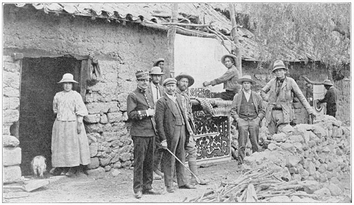
Isaiah
Bowman in the field with indigenous people, Peru, 1922
from Inca
Land: Explorations in the Highlands of Peru, by Hiram Bingham
Director of the Peruvian Expeditions of Yale University and the National
Geographic Society. Boston and New York: Houghton Mifflin Company.