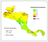
The CA Indigena project (Centroamérica Indígena, `Indigenous Central America´) tries to assist indigenous groups in the governance of their lands, while researching why some indigenous groups are more successful at acheiving cultural, political, territorial, and environmental stability than others.
The team is also developing strategies which incorporate remotely-sensed imagery with participatory researching mapping data, to create a web map portal that is frequently updated, illustrates historical resource management, and whose content and appearence is fundamentally controlled by the indigenous stakeholders.
Initial results include a better understanding of the emergence of new territorial jurisdictions in Honduras, and of the complicated nature of creating local management and governance structures in the area. Challenges include variations in official spatial data, both among and within countries. (ver abajo en español)
What is participatory research mapping?
¿Qué es la investigación cartográfica participativa? 2014 poster summarizing the project (pdf) - English and Spanish
Resúmen del proyecto en formato póster (pdf) - inglés y español Slide show about the project, part 1 (pdf)
Pase de diaposativas sobre el proyecto, 1a parte (pdf) Slide show about the project, part 2 (pdf)
Pase de diaposativas sobre el proyecto, 2a parte (pdf) 2015 poster summarizing the project and its accomplishments (pdf)
El proyecto CA Indígena (Centroamérica Indígena) se dedica a apoyar a los grupos indígenas en la gobernanza de sus tierras e investiga por qué algunos grupos indígenas logran la estabilidad cultural, política, territorial y ambiental mientras que otros no.
Además el equipo está desarrollando estratégias que incorporan imágenes de percepción remota con datos de investigación cartográfica participativa, para elaborar un portal de mapas web con actualización frecuente, que ilustra el manejo histórico de recursos, con contenido y aspecto controlado por los residentes indígenas.
Los resultados preliminares incluyen un mejor conocimiento sobre el surgimiento de nuevas jurisdicciones territoriales indígenas en Honduras y de las complejidades de las estructuras de manejo y gobernanza en la región. Los retos incluyen las inconsistencias en los datos espaciales oficiales, tanto entre los países como dentro de los mismos.