WARNING: The geographic position of each community map on the GoogleEarth background terrain is not exact in all places, due to differences in projection. Geographic information shown on these community maps represents only the part of the México Indígena database which each community consented to display in this format.
|
GIS (Geographic Information System)
México Indígena has developed an extensive multi-scale GIS, combining open-source layers and field data acquired through participatory methods. Much of this GIS is available for basic querying by any user, using SVG technology.
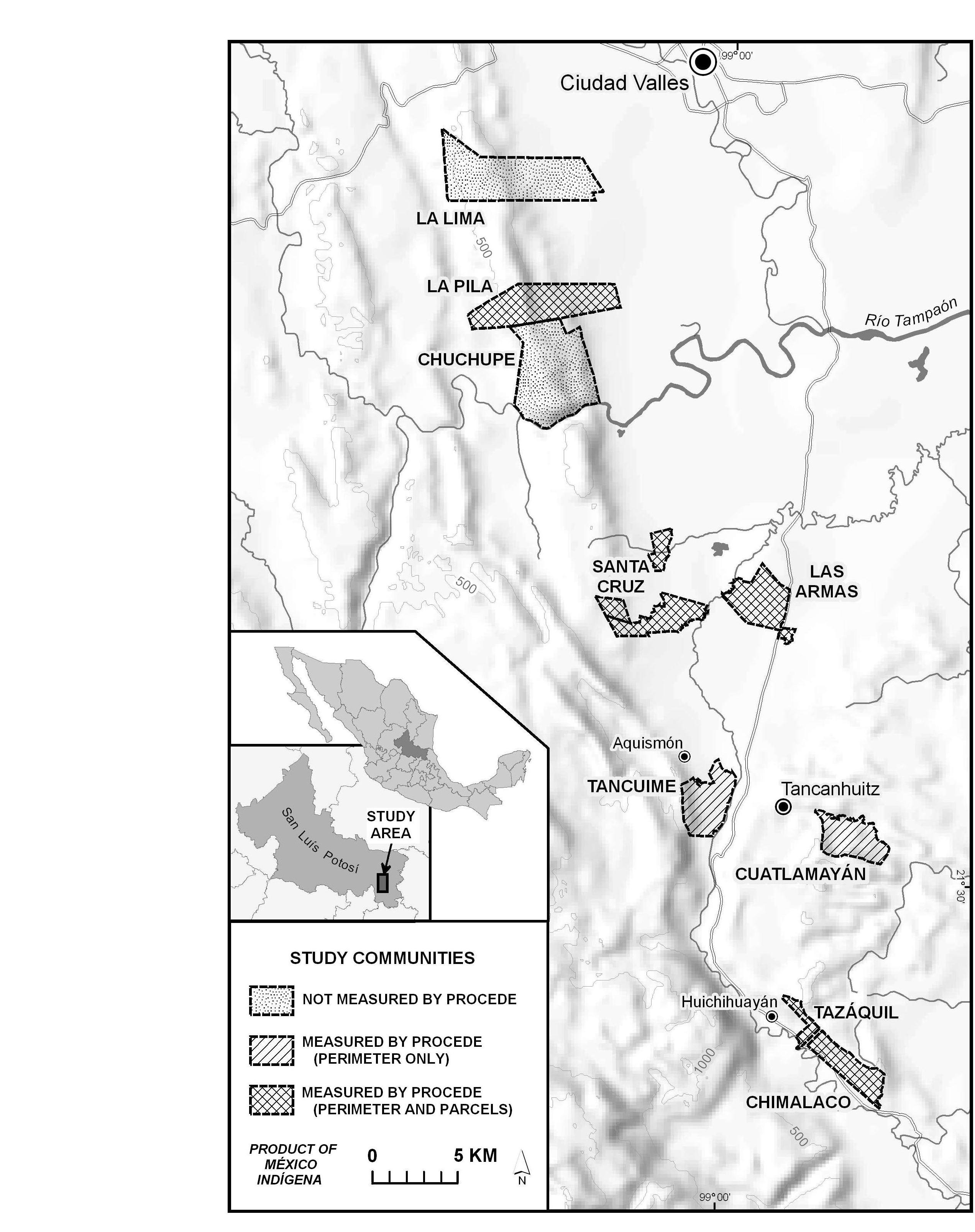
Additionally, the nine community
maps produced in 2005-2006 in the Huasteca Potosina may
be viewed as 3D images in GoogleEarth, in a new file format called
"kml". CLICK ON ANY COMMUNITY IN THE KEY MAP BELOW TO OPEN
ITS MAP.
(If you are asked to "open" or "save" the file,
choose "OPEN".
You can open it with any unzipping application, which may run automatically.
After it unzips, choose the file "DOC.KML")
Each map displays all geographic layers and toponyms (place names) which that community chose to include, and contains a legend (symbology key) in Spanish.
To view the maps, you must first download the free version of GoogleEarth, available here. The downloading process only takes about a minute for most internet connections.
If you prefer to view any community map as a jpeg image, click on a
thumbnail on the Huasteca Study Area page.