| |
|
||||||||||||
 |
|
||||||||||||
METADATA FOR MORE SAMPLE LAYERS
|
|
||||||||||||
|
|
||||||||||||
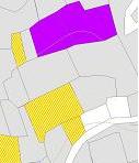
formal and informal land tenure change since PROCEDE by parcel PROCEDE tenure class zones (incl. subcategories of common use areas) ownership class (ejidatario or posesionario) by parcel communal work performed by parcel owner how parcel was acquired how parcel boundary is marked
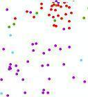
PROCEDE PROGRESS: communities (nucleos agrarios) surveyed by PROCEDE before April 2005, for several states percentage indigenous language speakers by localidad (community)
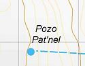
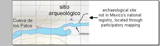
Local infrastructure and other CULTURAL FEATURES (from participatory mapping):
|
|
||||||||||||
Template copyright © 2005 - All rights reserved. Designed by: Web Design Directory |
|
||||||||||||